|
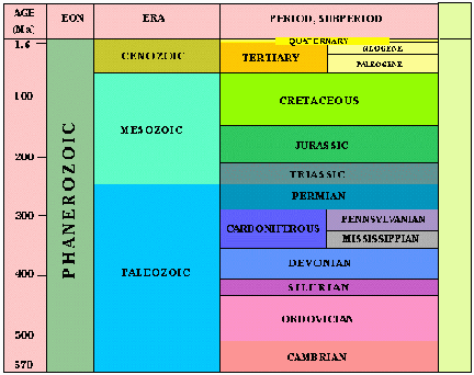
During the Ordovician period (which existed 500 million to 435 million years ago), the United States, and especially Ohio, looked very different than they do today. The land that is now present-day Ohio was mostly under water. This body of water extended from the Gulf of St. Lawrence to Ontario, Minnesota, North Dakota and the Atlantic Ocean. This water was deep in the eastern region of the state and became shallower as it progressed to the western side of the state.
The fossils of this period are found in the layers of shale and limestone. Because these stones exist in certain ecological conditions, it is possible to know what the land and environment were like during this period. Limestone is prevalent in deeper water, usually in the middle of oceans or seas. Shale is more abundant in the shallower water, closer to the shore. Because of this knowledge of these rocks, we can determine that at one time Ohio was covered with water. We can also hypothesize that where there is limestone, the water was deeper and where there is shale, the water was more shallow (Rocque and Marple 14-15).
|
|